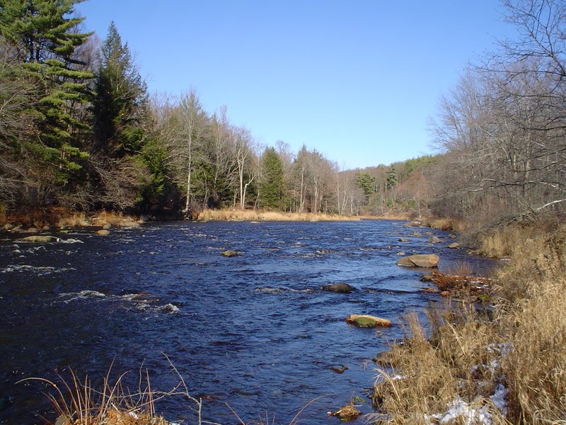
Start in Westfield along Rt 20 and begin to follow the Westfield River upstream. In Huntington you will see a tributary, the West Branch of the Westfield, come tumbling out of the Berkshire Hills to join the main river. That's what tributaries do.
Soon you will see another stream entering to join the flow. That's the Middle Branch of the Westfield. Now you will keep an eye peeled for the storied "East Branch" but you will never find a tributary or any notice of one after the mouth of the Middle Branch. Why is that? Well, it's because there is NO EAST BRANCH. The EB (East Branch) is really the MAIN RIVER (THE WESTFIELD RIVER).
Why do I say this? First, topo maps and the Army Corps of Engineers call the river above the Middle Branch the "WESTFIELD RIVER", pure and simple. Second, how can the EB be a tributary when it doesn't flow INTO a river and when it's daily flow, measured for close to a 100 years, so more than DOUBLE the flows of the West and Middle Branches combined. It's watershed, above the Middle Branch, is as long or longer than the the Westfield River from the Middle Branch mouth to the Connecticut River!
In short, the EB is really the WESTFIELD RIVER and not a branch at all. Forget what other groups say. Kayak folks call it the North Branch????? It is the Westfield River.
Am I about to change the name to something other than the EB?? No way. Just making a point on a cold Saturday afternoon when I've been tying a zillion flies and waiting to plow more snow tomorrow.
Think Spring!!
Ken

8 comments:
Ken,
It is interesting how the EB is the main stem, but referred to as the EB in so many places. I noticed the Farmington is similar. It has an EB and WB, where the west branch is the main stem. Even the Swift has (had) an east and west. My guess is the Westfield becomes the Westfield in Huntington, and it from there though varying in flow size, the three tribs diverge. In looking at old topo’s (one of fun winter habits) I’ve noticed there are a number of other streams similarly branched, the Ware being one.
Just for fun, if anyone’s interested (at the risk of hijacking your blog), UNH has historic topo maps of New England and New York. http://docs.unh.edu/nhtopos/nhtopos.htm Accessible on the web, they are lots of fun to review. They show old stream beds under the Quabbin, Wachusett, and other new reservoirs, the original flow of Northampton’s Mill River through the center of town, among other historic details.
Winter’s teeth are not yet letting go, though the days are lengthening. Looking forward to crocuses and drifting black winter stoneflies.
Bob O,
All very interesting stuff. Some people say that I'm wrong when I talk about the "Kempfield Pool" on the Millers saying instead that it is the Kentfield Pool named after Kentfield Rd. But a 1940ish topo map shows that Kentfield was once called Kempfield, hence the name of the pool.
My daughter and I spent lots of time on a site called Lost Ski Areas of New England. There were dozens of them - all gone! There's another site(s) devoted to old railroad lines in New England which is very interesting.
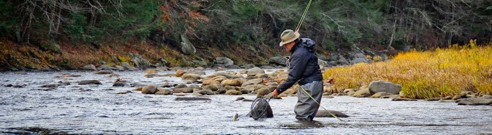
All good stuff to pour over when one can walk across a frozen EB.
Ken
Ken,
I might point out that Tom Fuller who has published several books and written extensive articles on New England Rivers states that the main stem of the Westfield river begins in the town of Huntington where all three branches (the West, the Middle & the East) merge into one. One article of his worth perusing was in TROUT magazine (Fall 2000). The article was titled "Westfield River, A Watershed That Hides In Plain Sight".
Fuller states what many people state and I disagree with them. I think of "branches" as having somewhat equal flow that forms a "main river". As I stated the "East branch" has a daily flow that is more than double the combined flow of the Middle and West Branches. That makes the Middle and West Branches more like tributaries of a major river. The gauge station for the "EB" is 29 miles above the confluence of the Westfield and the Connecticut River. There are as many river miles ABOVE this gauge as below. In short, the EB is the MAIN river with two small tributaries (West and Middle) whose flow, if you chocked it off, would not be visibly missed.
Today I was looking at a map from the US Army corp of Engineers who referred to the EB up in Savoy (headwater area) as the WESTFIELD River and not the EAST BRANCH. The other two tributaries were labeled as the Middle/West Branches.
Nothing is going to change here. I'll call the EB the EB but I know better!
Ken
Ken,
Non of this really matters but since it is February with 10' of snow outside...
Not sure you can define the EB as the main branch considering the fact that both the East Branch and the Middle Branch have flows based on regulated dam releases. Prior to the development of dams this might have been a better discussion.
I take alot of stock in Tom Fuller's writings. He has spent a lifetime studying and writing about many New England resources in detail and his information is regarded as highly accurate. If you happen to "disagree with what he and many agree with" you are certainly entitled.
But even more importantly, if you have read Tom Fuller's articles you will see that there are many, many more miles of high quality trout habitat beyond just the EB. Some containing wild trout at that. For the adventurous few that truly enjoy "getting out there", away from life and crowds, invest a day or weekend and explore the middle and west branches.
You'll be surprised what you might find.
Anonymous,
Everyone knows that the Knightville dam is nothing more than a holding pond for flood waters and through most of the season contains nothing more than a river just like Birch Hill dam on the Millers. Both are, for the MOST part, "run of the river" facilities and are not regulated releases. Littleville reservoir holds a permanent pond on the Middle Branch but it is also safe to say that what flows in is what flows out as in most dammed rivers. Why did you leave out the West Branch? In short, the "regulated dam release" argument holds no water (pun intended).
The Middle Branch has a watershed of 52.7 square miles. The West Branch watershed covers 94 square miles. Combined they total 146.7 square miles. The EB, from the gauge going upstream, totals 161 square miles. More than the combined size of the other watersheds and close to the combined flows of the others. A branch??
I like Fullers writing and have an autographed copy of his Trout Streams of Southern New England. I also know that he didn't name the branches but was just repeating the names that had been applied over the years.
My argument echoes the argument that was pointed out in CATSKILL RIVERS by Austin Francis. The Beaverkill and the Willowemoc Rivers meet at the Junction Pool and continue on as the Beaverkill River. The Willowemoc is considered a tributary of the "kill but Mr. Francis points out that the Willowemoc has a larger watershed and dumps more water into the Junction Pool than the storied Beaverkill. Why isn't the Beaverkill considered a tributary of the "Willow", logically the main river?
The EB will always be the EB as far as many recreational types are concerned except for the white water folks who will continue to call it the NORTH BRANCH. I will continue to call it the EB. Or maybe I'll call it the "Upper Westfield" (haha)
Ken
Ken,
I find it amazing how people only speak of the EB or the "Upper Westfield" as you aptly put it. One could spend years exploring the other two branches and nary see another person. Some of the most remote & beautiful reaches in MA are within this watershed. I guess it depends on one's own purpose when fly fishing.
The Middle Branch above Littleville is a gem. I never see anyone there.
Ken
Post a Comment